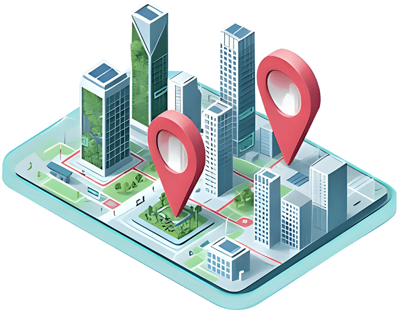
GIS Services
Turn location data into decisions. From mapping to spatial analytics and real-time geofencing, we build end-to-end GIS solutions that power operations, growth, and safety.
Enterprise-grade GIS, built for your business
Capecom designs, implements, and supports Geographic Information Systems that scale.
Whether you need field data collection, web maps for customers, or advanced spatial analytics,
our team delivers secure, high-performance GIS on cloud or on-prem. We integrate with your
ERP/CRM, automate data pipelines, and enable teams with beautiful, fast maps.
Faster decisions with location intelligence
Lower operating costs via route & network optimisation
Safer operations with geofencing & alerts
Better customer experience with real-time, map-driven UX
Our GIS Services
What we deliver
GIS Consulting & Architecture
Roadmaps, data models, security, cloud/on-prem design.
Spatial Analytics & ML
Hotspot detection, catchment analysis, demand forecasting, clustering.
Geocoding & Address Intelligence
Cleansing, standardisation, rooftop geocoding, reverse geocoding.
3D/DT & Visualisation
3D maps, terrain rendering, digital twins, indoor mapping.
System Integration
ERP/CRM/SCADA/IoT integration, message queues, event streams.
Web & Mobile GIS Apps
Map portals, dashboards, offline field apps, custom widgets.
Remote Sensing & Raster Processing
Satellite/Drone ingestion, NDVI/LCM, change detection.
Network & Routing Optimisation
Multi-stop routing, isochrones, fleet & engineer scheduling.
Data Engineering for GIS
ETL/ELT with GDAL/FME, tiling, vector/raster stores, data quality
Managed GIS & Support
SRE, monitoring, cost optimisation, upgrades, training.
Use Cases
Where GIS moves the needle
Utilities & Telecom
Network inventory, outage maps, fibre planning, field maintenance.
Retail & CPG
Store placement, trade areas, footfall, last-mile optimisation.
Agriculture & Forestry
Crop health (NDVI), yield prediction, asset monitoring.
Oil, Gas & Mining
Asset mapping, pipeline corridors, environmental monitoring.
Logistics & Supply Chain
Fleet tracking, route optimisation, depot catchments.
Smart Cities & Gov
Land records, permits, public dashboards, incident response.
Real Estate & Insurance
Risk scoring (flood/fire), valuations, portfolio maps.
Environment & ESG
Habitat mapping, emissions, conservation planning.
Why Capecom
Built by engineers, measured by outcomes
Full-stack geospatial + product
Geo + app + data + DevOps in one team.
Performance at scale
Tiles, caching, and indexes for sub-second maps.
UK-based leadership, global delivery
Faster comms, sensible costs.
Vendor-agnostic & open-source first
Right tool for your stack and budget.
Security & compliance
RBAC, SSO, audit trails, private networking.
Tech Stack
Tools we use (and integrate)
Platforms
ArcGIS Enterprise/Online, QGIS, GeoServer, Mapbox, CARTO, Google Maps, OpenLayers, Leaflet, CesiumJS.
Data & Engines
PostGIS, BigQuery GIS, Snowflake, Elastic, Tilestache/Tippecanoe, MBTiles.
Mobile Solution Development
GDAL/OGR, GeoPandas, Shapely, Rasterio, PyProj, Turf.js.
Cloud
AWS (S3, EC2, Lambda, Athena), Azure (Maps, Functions), GCP (GEE, GCS).
Market Development Strategy
FME, Airflow, dbt, Kafka, webhooks/IoT.
I will give the live link in 30min
How we work with you
Discovery & Architecture (2–3 weeks)
Requirements, data audit, target architecture, roadmap.
Analyze Data
Core workflows, key integrations, measurable KPIs.
Gauge Business Impact
Harden, automate, train, handover; optional managed support.
Engagement Options
Fixed-scope, Dedicated Team, or Outcome-based.
Sample Timeline
From idea to impact
Week 1–2
Workshops, data model, UX wireframes.
Week 3–6
Core features, first map & dashboard, CI/CD.
Go-Live
Observability, runbook, success metrics.
Week 7–10
Integrations, performance, UAT, training.
Case Study Teasers
Recent results
Potent open-source framework employing Dart in Flutter crafts natively compiled apps for web, mobile, and desktop. Leveraging the Dart’s beauty and efficiency of reactive programming to furnish impeccable user experience on Android and iOS.
Utility
Cut outage response time by 23% with network map + field app.
Retail
Improved site selection accuracy by 30% using catchment analytics.
Logistics
Reduced fuel cost 12% with multi-stop routing & geofencing.
Contact us for GIS Services
Possess an idea? Collaborate with Capecom and thrive as we commit to exceed expectations on every unique project that we take.